The Dynamic Duo of Water Infrastructure Management: Autodesk’s InfoWater Pro and Esri ArcGIS

If you work in water infrastructure management, you’ve likely encountered Autodesk InfoWater Pro and Esri ArcGIS. These powerful tools often work in tandem, helping engineers and water professionals address complex challenges. Let’s explore how these technologies complement each other and the key problems they can solve. InfoWater Pro is hydraulic modeling software designed specifically for […]
Integrating Autodesk Revit BIMs into ArcGIS 3D Scene Layers

Introduction In the evolving landscape of digital design and Geographic Information Systems (GIS), integrating Building Information Modeling (BIM) with GIS has become crucial for creating intelligent, data-driven urban environments. Autodesk Revit, a leading BIM software, enables detailed building design and construction planning. When integrated with ArcGIS 3D Scene Layers, it allows for immersive visualization, analysis, […]
Inventor Tips & Tricks – Fast Content Center Parts with the Open Command
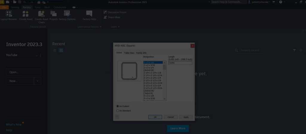
Inventor Tips & Tricks – Fast Content Center Parts with the Open Command
Controlling Bolted Connections by Editing the Excel Hole Tables

Controlling Bolted Connections by Editing the Excel Hole Tables
Utilize Math Functions for Powerful Parametric Patterns
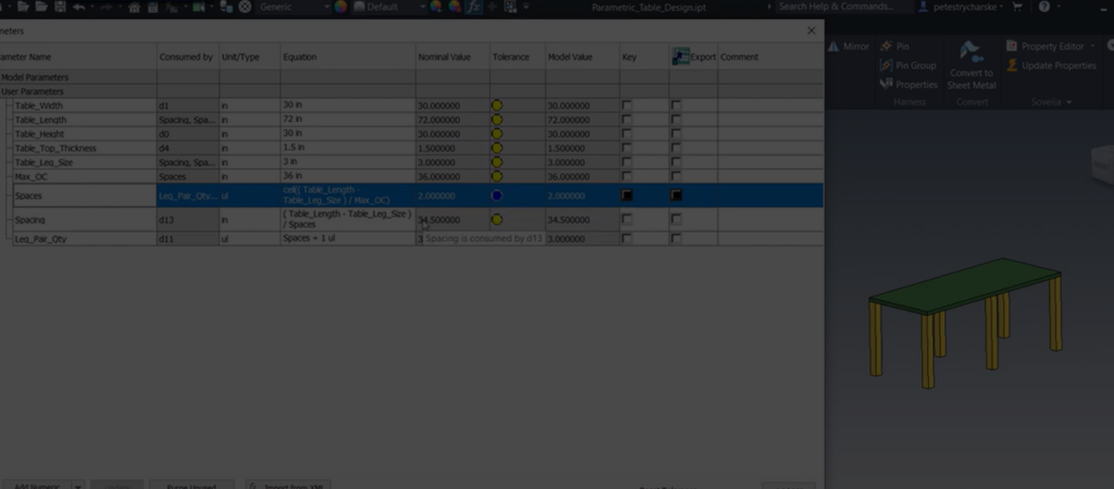
Utilize Math Functions for Powerful Parametric Patterns
Method for Controlling Frame Generator with Model States

Method for Controlling Frame Generator with Model States
How to Parameterize the Location and Orientation of a UCS

How to Parameterize the Location and Orientation of a UCS
Inventor – Centering a Hole in a Slot with the Joint Command

Inventor – Centering a Hole in a Slot with the Joint Command
Inventor – Driving Multiple Frames Using a Single Skeleton with Model States

Inventor – Driving Multiple Frames Using a Single Skeleton with Model States
Navisworks – How to Export Useful Geometry from a Model

Navisworks – How to Export Useful Geometry from a Model